 AI WEATHER AND
Offshore wind weather forecasts built for turbine access
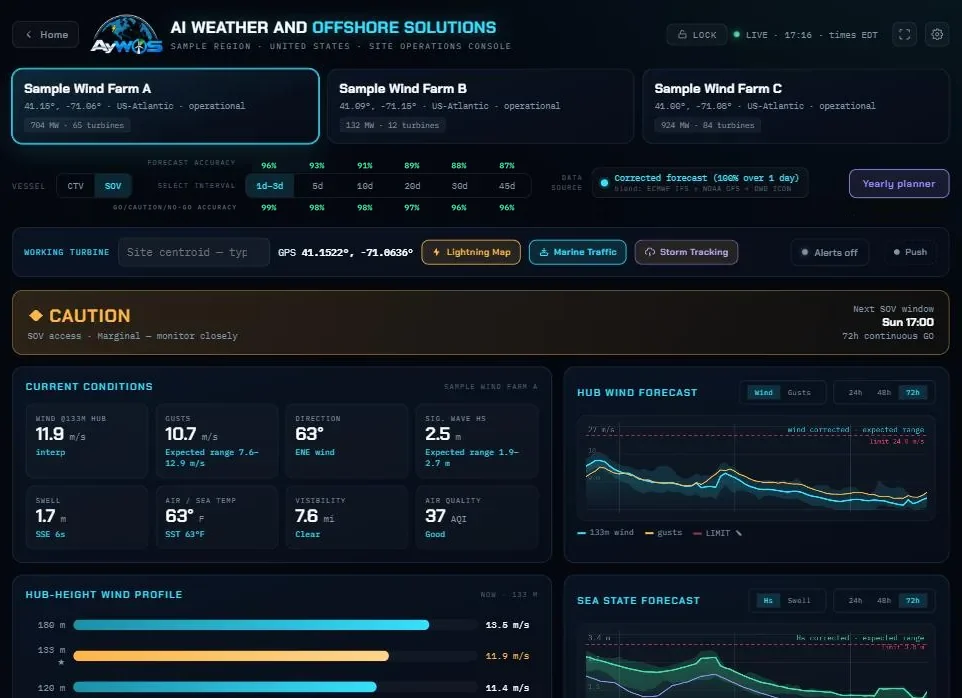
Hub-height wind and gusts, significant wave height and period, visibility and air quality for each wind farm — hour by hour to 72 hours, with an outlook to 45 days — and the forecast's own accuracy, measured against actual weather data collected from local sources.
Wind at the height the work happens
A crane lift, a nacelle climb or a blade inspection happens at hub height, 100 to 180 metres up, where the wind is stronger and gustier than the 10-metre figure most marine forecasts quote. The console reports wind and gusts at your turbine's hub height, with the profile from 80 to 180 metres, so the number on the screen is the one the technician will feel.
Over the sea, wind speed usually rises with height by a power law with an exponent near 0.1 to 0.14; in stable air after a warm spell it can rise much faster. That is why the profile matters: a 10-metre forecast stretched upward by a fixed rule is wrong exactly on the days it counts.
Sea state for every transfer
Significant wave height, swell and wave period, with an expected range around each hour rather than a single line, so a marginal morning looks marginal. The same hours are then judged against each vessel's limits — see crew transfer weather windows.
Blended, scored and corrected
Global models — ECMWF IFS, NOAA GFS and DWD ICON — are blended for each site. Every forecast is kept; when the actual weather data collected from local sources arrives, the two are compared.
Then the models compete. Several self-learning models are trained for each site and each parameter every learning cycle, and each is tested on data it has never seen. A challenger replaces the model in charge only when it clearly beats it, and the model that keeps on winning is awarded that site's forecast — the champion. A champion that stops winning is retired, and where no model beats the raw forecast, the raw forecast is used.
The accuracy is then shown in the console for each look-ahead — 1 to 3 days, 5, 10, 20, 30 and 45 days — so crews know how far ahead to trust it. Short leads score highest; beyond about five days every forecast loses skill, and the figures say so.
Read as a decision
Numbers become a verdict: GO, CAUTION or NO-GO for the vessel you choose, and the time the next continuous window opens. Planning further out, the 45-day outlook and the yearly planner show which weeks are likely to work.
Questions
How are your forecasts calculated?
The global models are blended for each site and every forecast is scored against actual weather data collected from local sources. Several self-learning models then compete to correct it: each is tested on data it has not seen, a challenger takes over only by clearly beating the model in charge, and the model that keeps winning is awarded that site's forecast.
What is hub-height wind and why does it matter?
It is the wind at the height of the turbine's rotor hub, typically 100 to 180 metres above the sea. It is stronger and gustier than the 10-metre wind in most marine forecasts, and it sets the limits for work on the nacelle and for lifts.
How far ahead can an offshore forecast be trusted?
Hour-by-hour forecasts are most reliable for the first one to three days. Skill falls with lead time; AyWOS shows the measured accuracy for each look-ahead so you can see exactly how quickly.
Which regions are covered?
Forecasts cover offshore wind sites worldwide. Storm tracking with NEXRAD radar and HRRR future radar covers the United States and nearby waters, with radar composites elsewhere.
Related
See the forecast for your own wind farm.
Tell us your sites and vessels and we will show you the console on your own wind farm.