 AI WEATHER AND
Storm tracking for offshore wind: radar now, future radar ahead
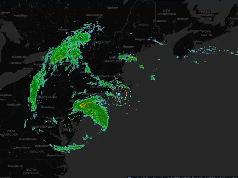
The radar at this moment, NOAA's HRRR future radar for the next hours, and the two blended in between — with your site's warning rings on the same map, anywhere you pan.
The radar, at the present moment
In the United States the present moment is NEXRAD radar, the National Weather Service's network of Doppler radars, served through Iowa State University's mesonet. Beyond its reach the view uses Environment and Climate Change Canada's radar composite and a global radar mosaic, so a storm is drawn wherever the map is.
The next hours: radar handed over to the model
For the first half hour the observed radar is carried forward along the storm's motion. From there it is blended, step by step, into the HRRR — NOAA's High-Resolution Rapid Refresh model, run every hour — which carries the forecast by two hours, because a model can grow, decay and turn a storm where moving a picture cannot. Play eight hours in 15-minute steps, or finer.
Motion that follows the storm
The storm's speed and direction are read by matching the rain pattern from one 15-minute frame to the next, the way radar nowcasting works, instead of following the centre of all the rain in view — which orbits a turning system and used to point the wrong way. When the field is turning, the turn is measured and the radar is turned with it. When the rain has no clear motion, the view says so and holds the radar where it was observed while the model takes over.
What the colours mean
Rain, thunderstorm, hail risk, snow and blizzard. A thunderstorm is rain with convective energy (CAPE) of 1,000 J/kg or more, hail risk 2,500 J/kg or more, and a blizzard is snow with wind of 35 mph or more: operational rules of thumb, stated so they can be judged.
Questions
Is the future radar a forecast?
Yes. Beyond the present moment the picture is the HRRR model's simulated radar, blended from the observed radar over the first two hours. It is labelled as such in the view.
Does storm tracking work outside the United States?
The present-moment radar does, through Canada's composite and a global mosaic. HRRR covers the contiguous United States and nearby waters; elsewhere the model field comes from global forecast data.
Why does the header sometimes say “no clear motion”?
When scattered showers pop up and die where they are, or the rain does not move as one, a single speed and direction would mislead. The view then holds the radar in place and lets the model carry the forecast.
Related
Watch the next storm come in on your own sites.
Tell us your sites and vessels and we will show you the console on your own wind farm.